Mountains and wetlands, beaches and forests, volcanoes, lava and lakes. Spain's National Parks are distinctive for their variety, but above all, for their stunning ecological wealth.
Stretching from the Pyrenees to the Canary Islands, Spain's National Parks are well worth discovering. They cover a total of more than 325,000 hectares of land and have an immense natural and cultural value, all but untouched by man over the centuries, and enjoy special state protection. These areas all share some common features, such as their spectacular landscapes, although each National Park has its own special character which makes it unique and distinctive. Here are the TOP 10 -
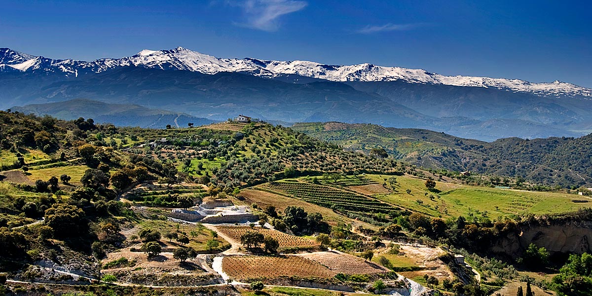
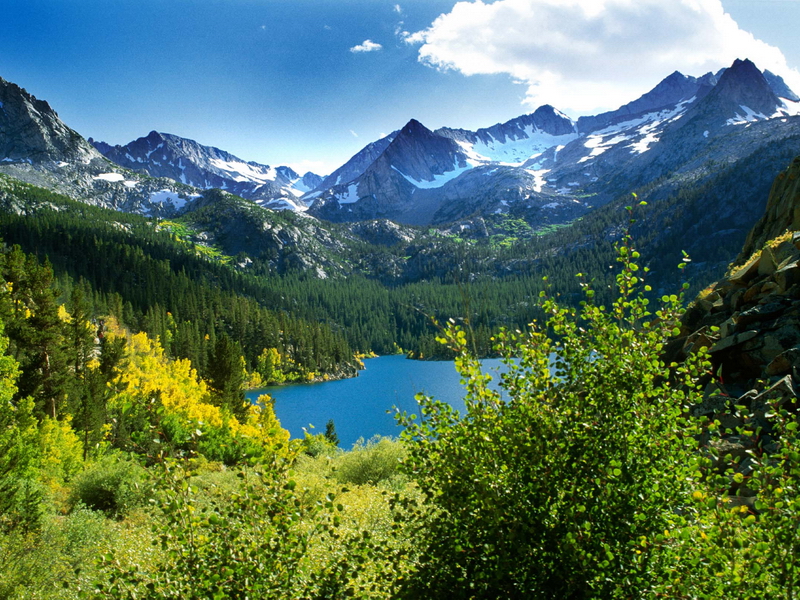
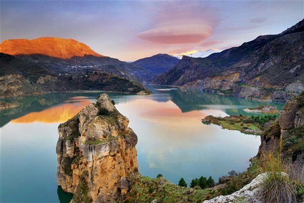
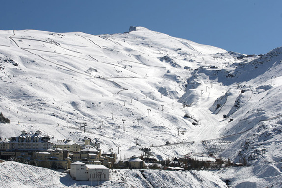
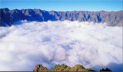
1. National Park Sierra Nevada, Granada & Almería
The Parque Nacional Sierra Nevada is located in Granada and Almería provinces in south-eastern Spain. It was declared a national park on 14 January 1999. It stretches from the Alpujarra to El Marquesado and the Lecrin Valley, covering a total area of 85,883 hectares,[1] making it the largest national park in Spain. There are more than 20 peaks over 3,000 meters, with the highest being Mulhacén (3479 m),[2] Veleta (3396 m)[3] and Alcazaba (3371 m).
The rivers that rise on the north face of the range feed the Guadalquivir basin, the most important ones being the Fardes and Genil. Meanwhile, the rivers that rise on the west and south faces run down into the Mediterranean. These include the Dúrcal, Ízbor, Trevélez and Poqueira, which are all tributaries of the Guadalfeo, which itself rises in the Sierra Nevada, and the Adra and Andarax, with their tributaries. The south and west faces are where you will find the majority of the almost 50 high-mountain lakes that exist in the Sierra Nevada, many of which are also the sources of streams and rivers.
Much of the landscape, particularly above 2,400 metres (which was the perpetual snow line prior to the Holocene period) was shaped by the action of glaciers, resulting in characteristic U-shaped valleys.
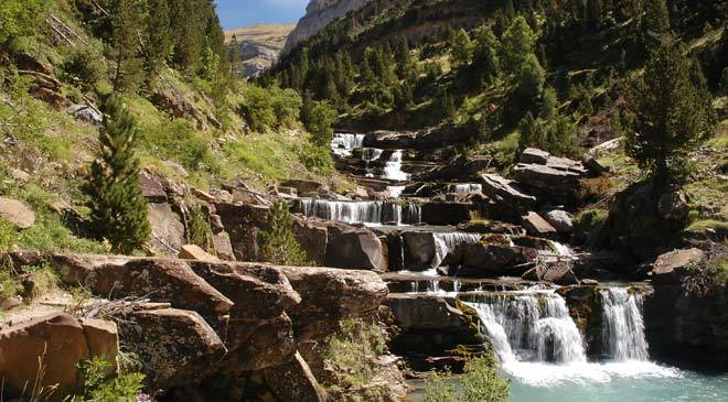
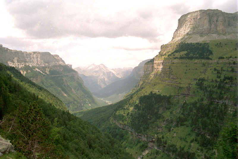
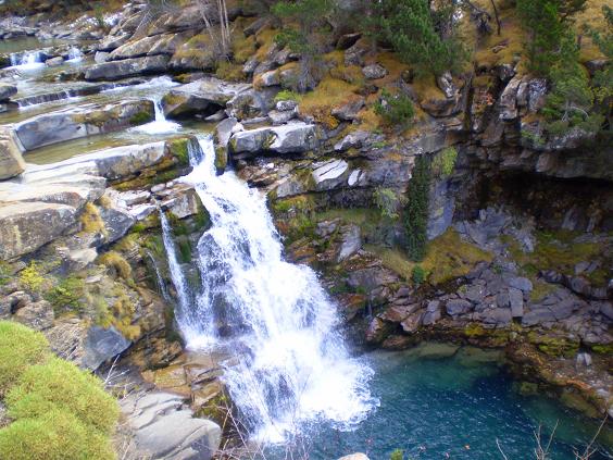
2. National Park de Ordesa & Monte Perdido, Aragón, Huesca
The National Park is part of the Pyrenees and Monte Perdido National Park which was declared a World Heritage site in 1997 by the UNESCO. Since 1977, a part of the park has also been inside the Ordesa-Viñamala Biosphere Reserve.
It is an incredibly beautiful place with a landscape of towering summits. It has a wide variety of ecosystems with both an Atlantic and Mediterranean influence, which is what gives it such a rich and diverse flora and fauna. The scenery is dominated by the great massif of Monte Perdido (3,355 m), with the peaks of the Tres Sorores branching out into the valleys of Ordesa, Pineta, Añisclo and Escuaín.
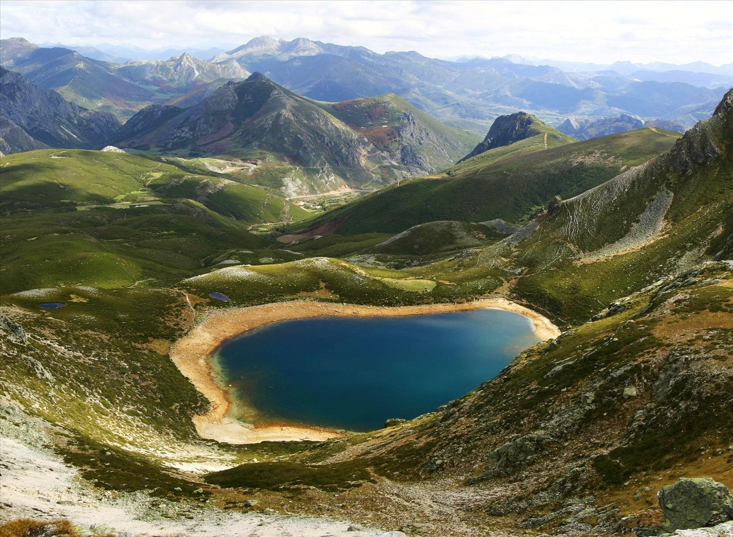
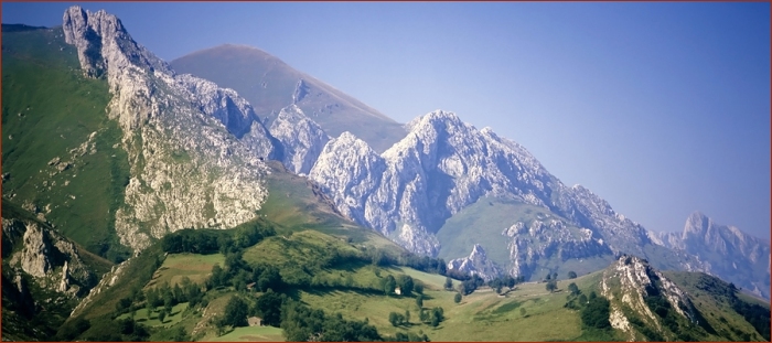
3. National Park Picos de Europa, Castilla & León, Asturias y Cantabria
The Picos de Europa National Park (Spanish: Parque Nacional de Picos de Europa) is a National Park in the Picos de Europa mountain range, in northern Spain. It is shared by the autonomous communities of Asturias, Cantabria and Castile and León. It was the first of the National Parks of Spain along with Ordesa y Monte Perdido National Park in the Pyrenees. When it was created 22 July 1918 it covered the western part of today's national park, centered on the Lakes of Covadonga. The Parque Nacional de la Montaña de Covadonga, as it then was called, had an area of 169.25 km².
On May 30, 1995 the park was extended to include its current total area of 646.60 km². On July 9, 2003 UNESCO approved Biosphere Reserve status for the National Park. Picos de Europa is one of several biosphere reserves in the Cantabrian Mountains which are being integrated into a single super-reserve to be known as "Gran Cantábrica". The total area of the park is 646.60 km² and is shared by Castilla y León, Asturias, and Cantabria.
The highest point of the park is in Torre de Cerredo peak, 2,648 m AMSL and the lowest point is 75 m AMSL in the Deva River, that is, a vertical drop of 2,573 m. The geological features of the park show the effects of glacial erosion on the limestone massifs that form the Cantabrian Mountains.
 15.52.01.png)
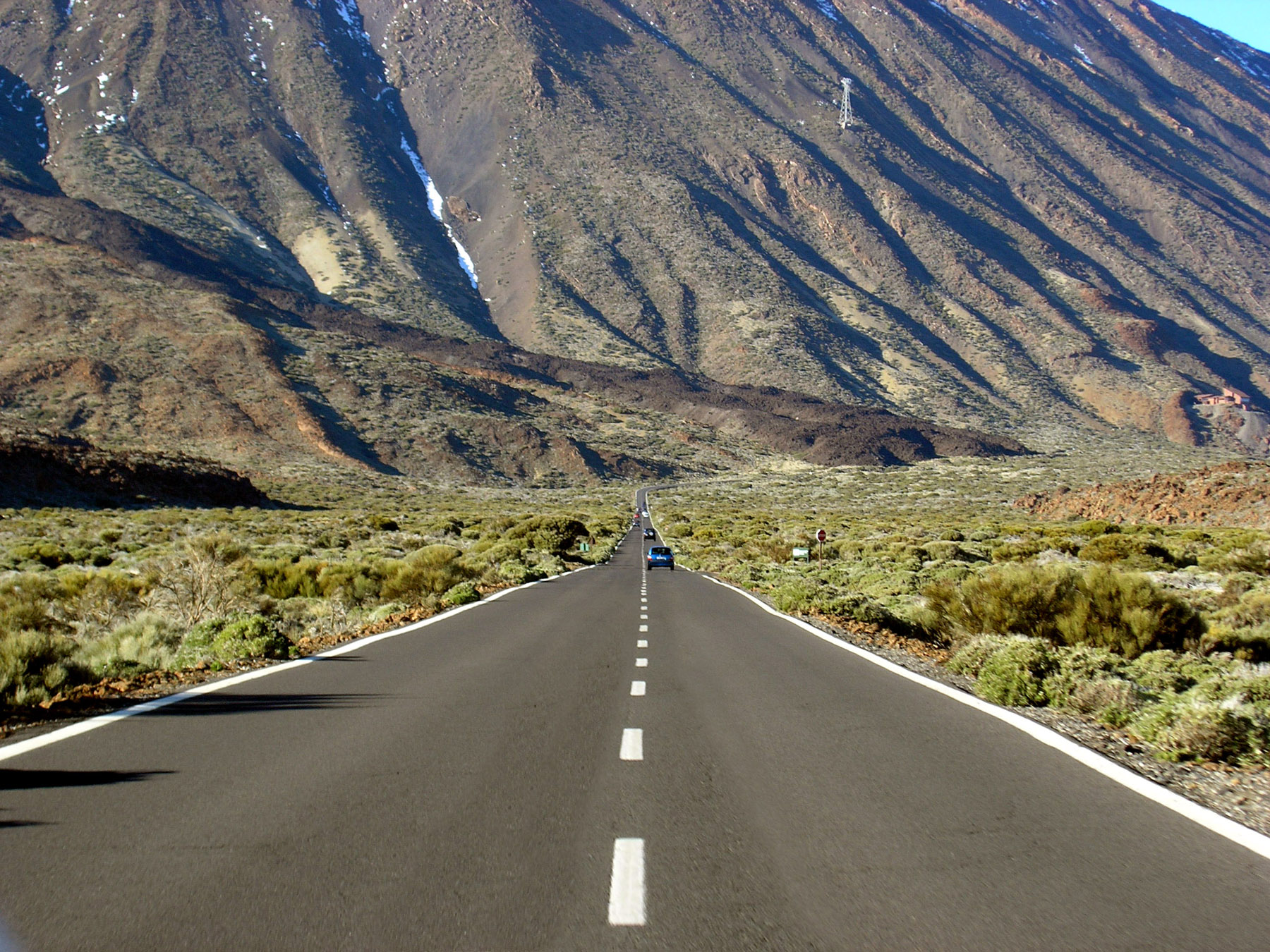
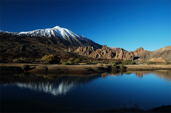
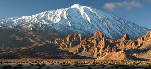
4. National Park Teide, Isla de Tenerife
Teide National Park (Spanish: Parque Nacional del Teide) is a national park located in Tenerife (Canary Islands, Spain). It is centered around 3718 m Mount Teide, the highest mountain of Spain and the islands of the Atlantic (it is the third largest volcano in the world from its base on the ocean floor). It was declared a national park on 22 January 1954, making it one of the oldest national parks in Spain. It is also the largest national park in Spain and an important part of the Canary Islands. Another volcano located in the park (next to the Teide) is the Pico Viejo. It is the second largest volcano in the Canary Islands with its 3,135 m peak.
The park has an area of 18,990 hectares and was named a World Heritage Site by UNESCO on June 29, 2007.[1] Since the end of 2007, it has also been one of the 12 Treasures of Spain. Midway up the mountain are the telescopes of the Observatorio del Teide. Territorially, it belongs to the municipality of La Orotava. Teide is the most visited national park in Spain, with a total of 2.8 million visitors, according to the Instituto Canario de Estadística (ISTAC), and it is one of the most visited National Parks in the world.The Teide is the most famous natural icon not only of Tenerife but also of all the Canary Islands.
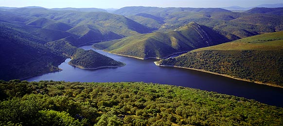
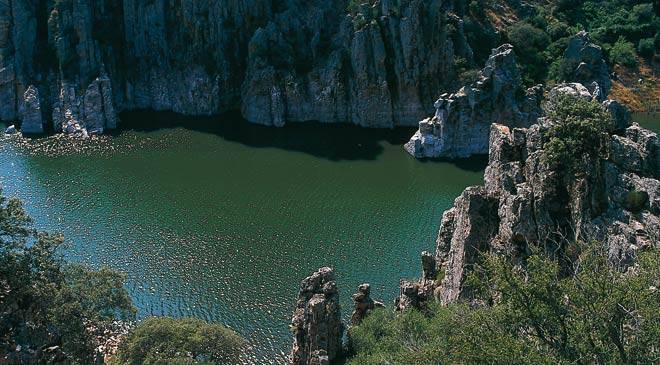
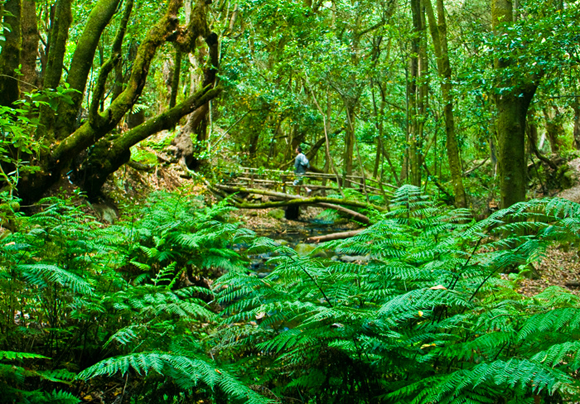
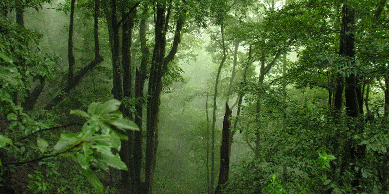
5. National Park of Monfragüe, Cáceres, Extremadura
The largest and best preserved Mediterranean forest worldwide is in Monfragüe (Extremadura), surrounded by hills populated with oak forests and Mediterranean thicket and dotted with rocks and streams. Rivers and reservoirs irrigate the riverside areas of Monfragüe National Park. All this results in a rich and varied plant and animal life. It situated in the north of the province of Cáceres (Extremadura), in the imaginary triangle formed by the cities of Cáceres, Plasencia and Trujillo.
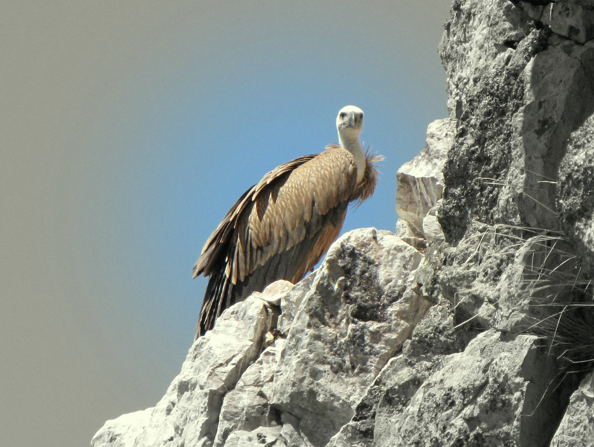
The ancient presence of man in these lands is shown in the cave paintings of the Castillo cave. The Castillo cave of Monfragüe, of Arabic origin, dominates an impressive rocky area on the waters of the Tajo River. Also worth visiting is the Puente del Cardenal bridge and the village of Villarreal de San Carlos. Very interesting locations, such as Plasencia, Trujillo and Cáceres, await in the surrounding areas. Monfragüe National Park has the largest colony of black vultures in the world (over 200 pairs), it has the world's highest concentration of imperial eagles (more than 10 pairs) and is one of the few habitats where the Iberian lynx has survived.
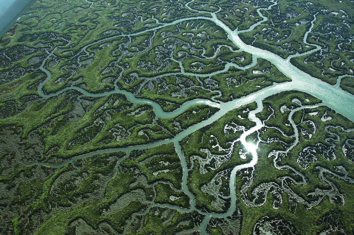
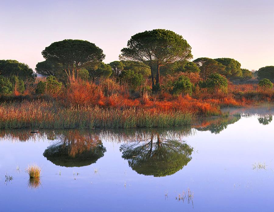
6. National Park Doñana, Andalucía
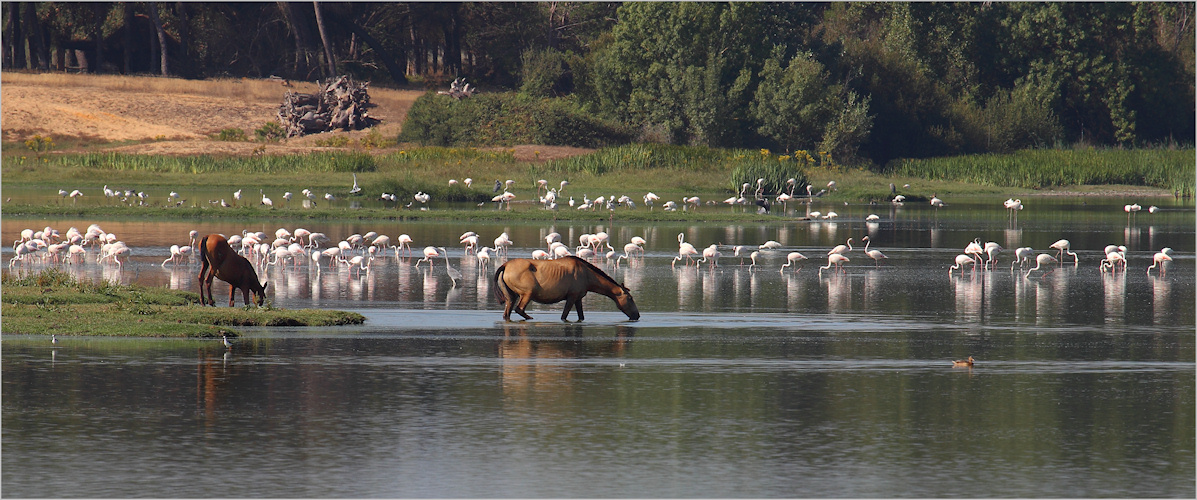
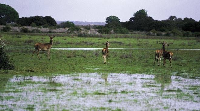
Doñana National Park is a natural reserve in Andalusia, southern Spain, in the provinces of Huelva and Seville. It covers 543 km2 (209.65 sq mi), of which 135 km2 (52.12 sq mi) are a protected area. The park is an area of marshes, shallow streams, and sand dunes in Las Marismas, the delta where the Guadalquivir River flows into the Atlantic Ocean.
It was established as a nature reserve in 1969 when the World Wildlife Fund joined with the Spanish government and purchased a section of marshes to protect it.The eco-system has been under constant threat by the drainage of the marshes, the use of river water to boost agricultural production by irrigating land along the coast, and the expansion of tourist facilities.It is named after Doña Ana de Silva y Mendoz, wife of the seventh Duke of Medina-Sidonia. Doñana National Park has a biodiversity that is unique in Europe, although there are some similarities to the Camargue river delta in France, which contains the Parc Naturel Régional de Camargue, with which Doñana Park is twinned.The park features a great variety of ecosystems and shelters wildlife including thousands of European and African migratory birds, fallow deer, Spanish red deer, wild boars, European badgers, Egyptian mongooses, and endangered species such as the Spanish Imperial Eagle and the Iberian Lynx.
The Doñana nature reserve includes both the Doñana National Park, established in 1969, and the Natural Park, created in 1989 and expanded in 1997, creating a buffer zone of protection under the management of the regional government. The two parks, national and natural, have since been classified as a single natural landscape. Due to its strategic location between the continents of Europe and Africa and its proximity to the Strait of Gibraltar, Doñana's large expanse of salt marsh is a breeding ground as well as a transit point for thousands of European and African birds (aquatic and terrestrial), and hosts many species of migratory waterfowl during the winter, typically up to 200,000 individuals. Over 300 different species of birds may be sighted there annually. Considered the largest nature reserve in Europe, several different scientific institutions have monitoring stations within its boundaries to ensure appropriate development of adjacent lands and conservation of the threatened species that inhabit it. The area was declared a World Heritage Site by Unesco in 1994.
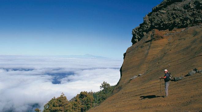
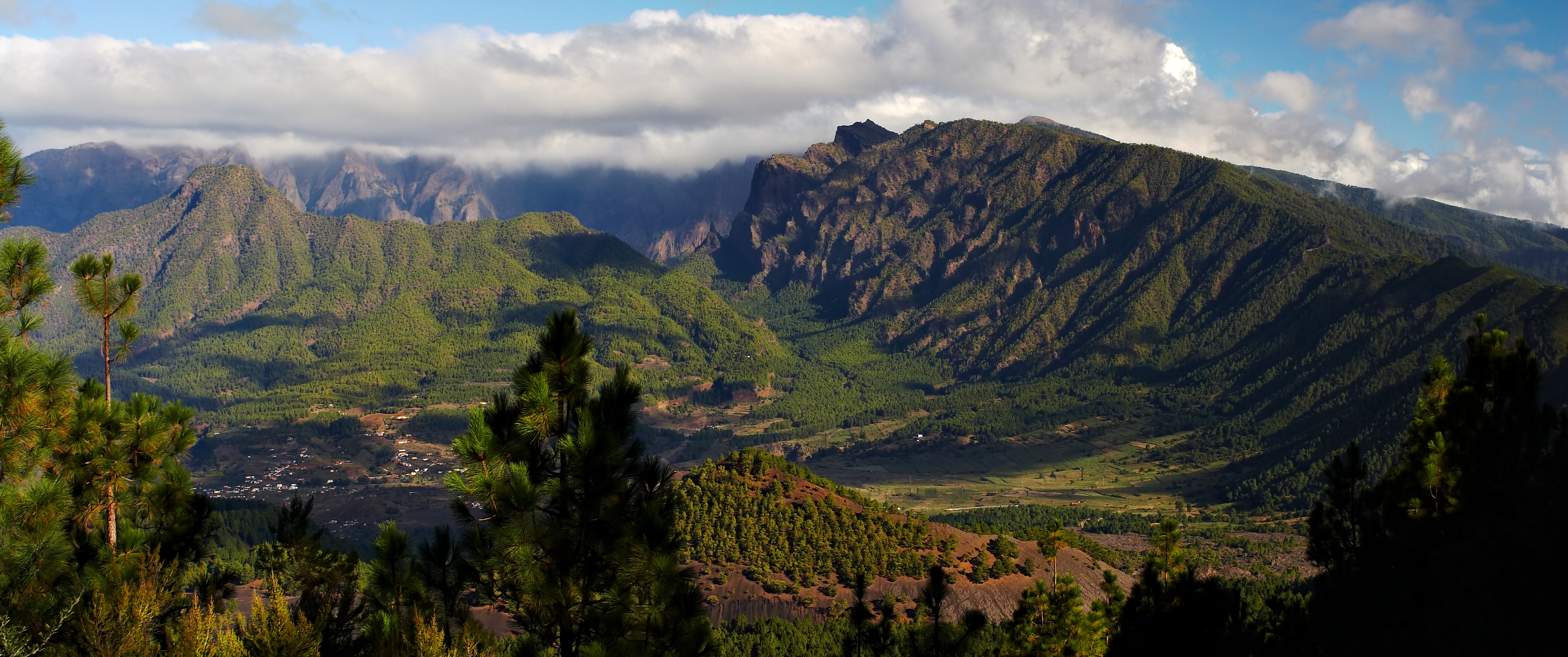
7. National Park Caldera del Taburiente, Isla La Palma, Canarias, Tenerife
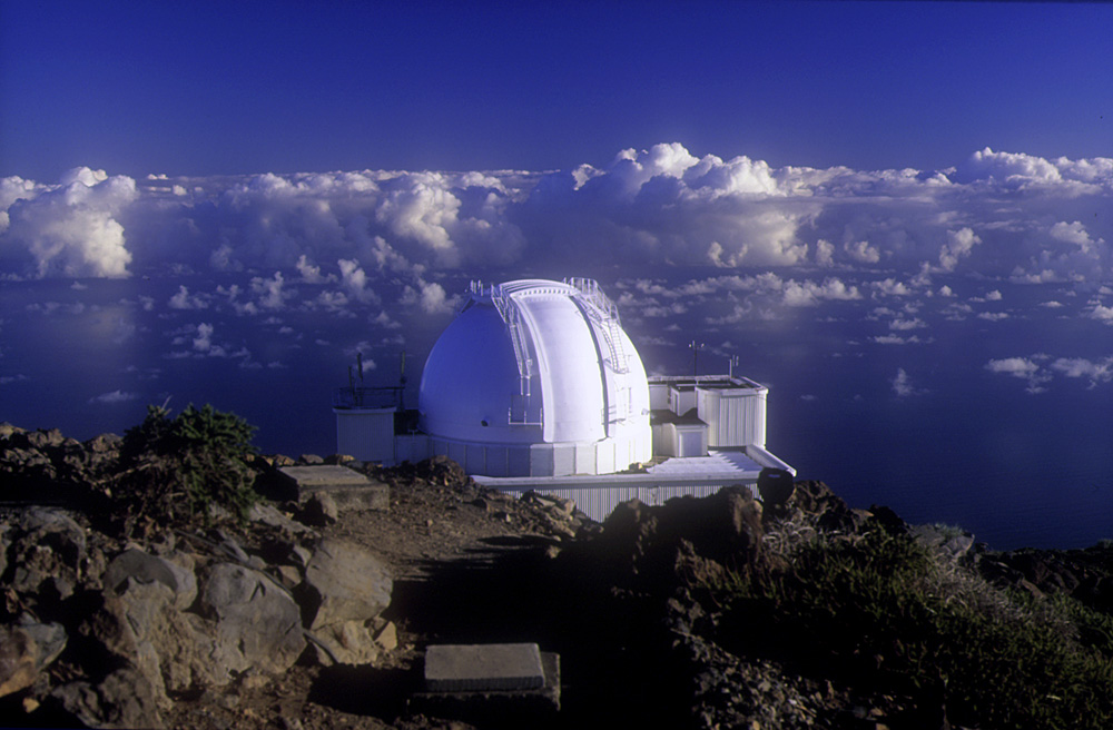
Caldera de Taburiente National Park is a national park on the island of La Palma, Canary Islands, Spain. It contains the enormous expanse of the Caldera de Taburiente, once believed to be a huge crater, but nowadays known to be a mountain arch with a curious crater shape, which dominates the northern part of the island. It was designated as a national park in 1954.
The caldera is about 10 km across, and in places the walls tower 2000 m over the caldera floor. The highest point is the Roque de los Muchachos on the northern wall, at 2426 m altitude, which can be reached by road. The telescopes of the Roque de los Muchachos Observatory are situated very close to the summit. During the Spanish conquest of the Canary Islands in the 15th century, the caldera was the site of the last stand of the indigenous people of the archipelago, the Guanches. It proved impregnable to the invading Spaniards, and they only defeated the Guanches by luring their leader out on the pretext of holding talks. The Cumbrecita is at a lower point in the south-eastern part of the caldera's rim, giving a good view into the Caldera. In the south-west the caldera opens to the sea, through a riverbed known as Barranco de las Augustias. The Cumbre Nueva is a ridge that starts at the caldera and continues to the south.
The main flora of the national park comprises a large forest of Canary Island Pine, with important population of the endangered Canary Islands Juniper also present. The caldera originated some 2 million years ago, with a massive shield volcano about 20 km in diameter. The caldera was not formed by an explosion of that volcano however, but by erosion starting from the volcano's original crater. The word "caldera" means "cauldron" in Spanish.
In 1815 the great German geologist Christian Leopold von Buch visited the Canary Islands during which he visited the island of Tenerife where he was taken to the Caldera de las Cañadas. He visited La Palma after he had been to Tenerife and in his journal he makes it clear that he was able to distinguish between a caldera of volcanic origin and the erosional origins for the caldera Taburiente. Following his return to Germany he published his journal and he introduced the term "Caldera" to the geological vocabulary. Taburiente is not a Spanish word but derives from the Guanche language and means "plain, level".
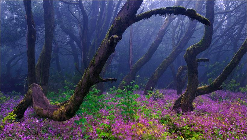
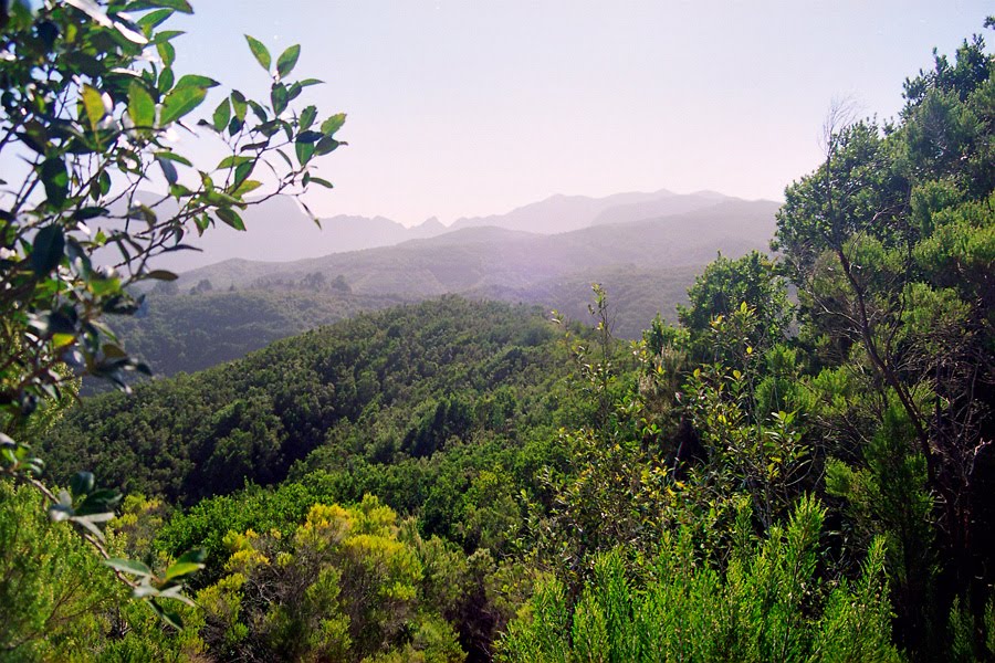
8. National Park Garajonay, Isla Gomera
Garajonay National Park is located in the center and north of the island of La Gomera, one of the Canary Islands (Spain). It was declared a national park in 1981 and a World Heritage Site by UNESCO in 1986. It occupies 40 km2 (15 sq mi) and it extends into each of the six municipalities on the island. The park is named after the rock formation of Garajonay, the highest point on the island at 1,487 m (4,869 feet). It also includes a small plateau whose altitude is 790-1,400 m above sea level.
The park provides the best example of Canarian laurisilva, a humid subtropical forest that in the Tertiary covered almost all of Southern Europe. It is also found on the Azores and the Madeira Islands. Laurus azorica, known as Azores Laurel, or by the Portuguese names Louro, Loureiro, Louro-da-terra, and Louro-de-cheiro, can be found in the park, as well as Laurus novocanariensis, known as Canary Laurel. Although named as a single type of forest, the National Park englobes several varieties of forests. Most humid and protected valleys oriented to the North have the richest and most complex forests. It is known as valley laurisilva, a true subtropical rainforest where the largest laurel trees can be found. At higher altitudes, with less protection from wind and sun, the forest loses some of its more delicate species. Here it is called slope laurisilva (laurisilva de ladera).
At the south the forest is mainly a mix of beech and heather, species adapted to the less humid atmosphere. Other attractions of the National Park are the massive rocks that are found along the island. These are former volcanoes whose shapes have been carved by erosion. Some, like the "Fortaleza" (fortress in Spanish) were considered sacred by the native islanders, as well as ideal refuges when attacked. The park is crossed by a large network of 18 footpaths, trekking being one of the main tourist activities in the island.
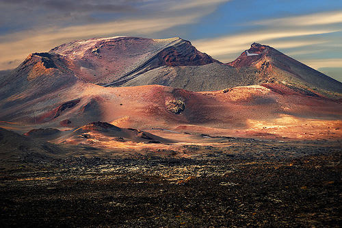
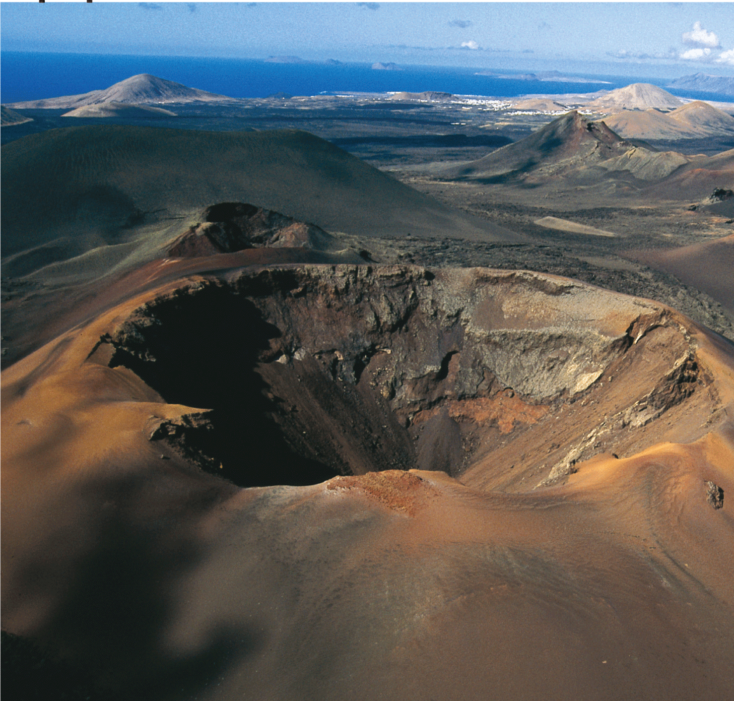
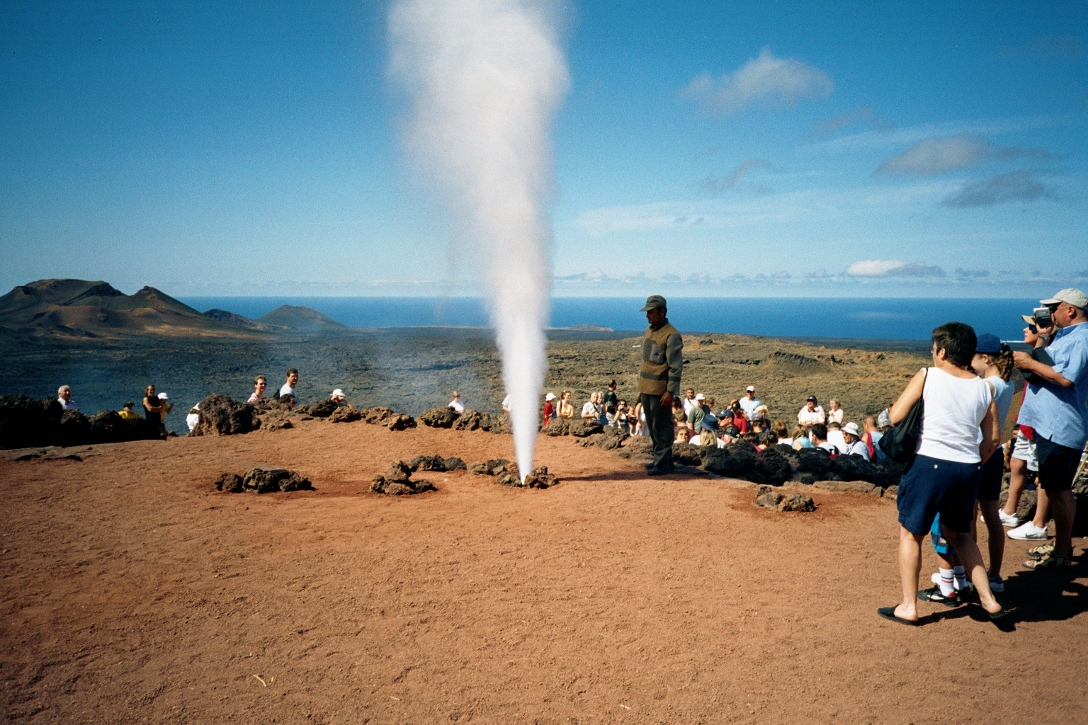
9. National Park Timanfaya, Isla de Lanzarote, Canarias
Timanfaya National Park (Spanish: Parque Nacional de Timanfaya) is a Spanish national park in the southwestern part of the island of Lanzarote, Canary Islands. It covers parts of the municipalities Tinajo and Yaiza. The area is 51.07 square kilometres (19.72 sq mi).[1] The parkland is entirely made up of volcanic soil. The greatest recorded eruptions occurred between 1730 and 1736. The volcanic activity continues as the surface temperature in the core ranges from 100 to 600 °C at the depth of 13 metres (43 ft), which is demonstrated by pouring water into the ground, resulting in a geyser of steam which is an attraction for tourists.
There is only one active volcano, Timanfaya volcano which the park is named after. In 1993, UNESCO designated a Biosphere reserve covering the whole of Lanzarote. The national park is one of the core areas of the biosphere reserve. Access to the park by the public is strictly regulated to protect the delicate flora and fauna. There are one or two footpaths, and a popular short route where one can visit by camel. There is a public car park from which one can tour the volcanic landscape by coach using a road that is otherwise closed to the public.
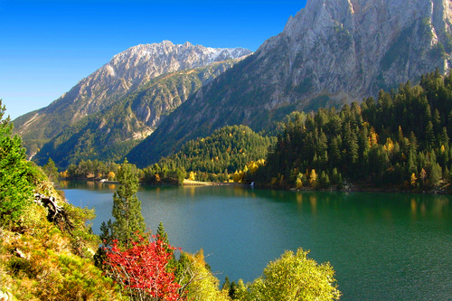
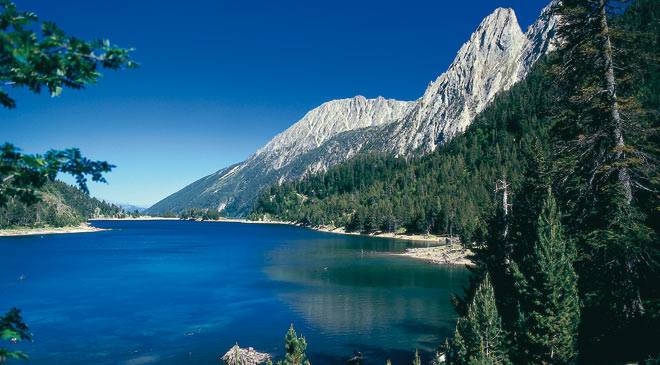
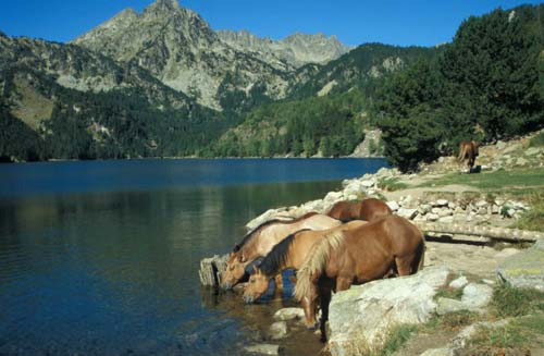
10. National Park Aigüestortes i Estany de Sant Mauricio, Cataluña
Aigüestortes i Estany de Sant Maurici National Park is only one located in Catalonia. A wild mountain region in the Pyrenees, with peaks rising to 3017 m (Besiberri Sud) and with nearly 200 lakes, many of them of glacial origin, the park comprises a core area of 141 km² and a buffer zone of 267 km² surrounding the park. The park's name in Catalan is Aigüestortes i Estany de Sant Maurici, freely translated as "The winding streams and lakes of St. Maurice".
The park has an elevation range of 1600 to 3000 metres and contains four major vegetation zones: lower montane, upper montane, subalpine and alpine. The fauna includes Pyrenean chamois, marmot, ermine, roe deer, among other mammals and numerous birds (Black Woodpecker, Common Crossbill, Lammergeier, Golden Eagle). The park was created in 1955 after Ordesa y Monte Perdido National Park, first Spanish National Park in the Pyrenees in 1918. Its administrative seats are in Espot and Boí. The park is mainly located in the comarques of Pallars Sobirà and Alta Ribagorça. The National Park comprises 40,852 ha., divided in two different levels of protection: the core area and the buffer zone surrounding the park. This buffer zone creates a gradation from the inner side, more strictly protected than the external parts of the park.
The core area is located in the comarques of Pallars Sobirà and Alta Ribagorça, and includes the main entrances of the Park: On the west side, from the village of Boí, is the Aigüestortes plain. Aigüestortes means "winding waters" and is largely flat which allows the river to meander and flow slowly. This area indicates the existence of an old lake, today covered by sediment. To the east, near the village of Espot, is Sant Maurici lake, one of the most famous of the region, from where you can see the spectacular twin peaks of the Encantats. This scene is one of the symbols of the Park and is the logo of the Park. This area also includes part of the municipalities of Vielha e Mijaran and Naut Aran in the Val d'Aran; Vilaller and Vall de Boí in the Alta Ribagorça; La Torre de Cabdella in the Pallars Jussà; and Espot, Alt Àneu, Esterri d'Àneu, La Guingueta d'Àneu and Sort in the Pallars Sobirà. The buffer zone also contains numerous areas of natural beauty and value, such as the forest of la Mata de Valencia, Gerber and Cabanes valleys, Colomers and Saboredo valleys, the Besiberri valley, the lakes of Cabdella and Montardo peak.